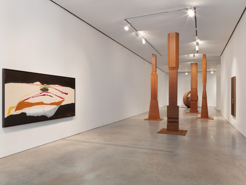
| For the past several years I have been working on a series of cartographic installations comprised of layers of hand-cut paper, light, and shadow. These constructions depict aspects of the world which we cannot normally see: a microscopic organism, an image from the depths of our interior anatomy, a labyrinth of pipes and systems buried beneath us, or the land we live on as it was 200 years before. I am interested in how these inaccessible places are transformed once they are flattened into two dimensions and mapped out, and how the visualization of information, a system, landscape or history, creates an abstraction that can be simultaneously informative and ambiguous. | 
|
Adriane Colburn lives and works in San Francisco, California.
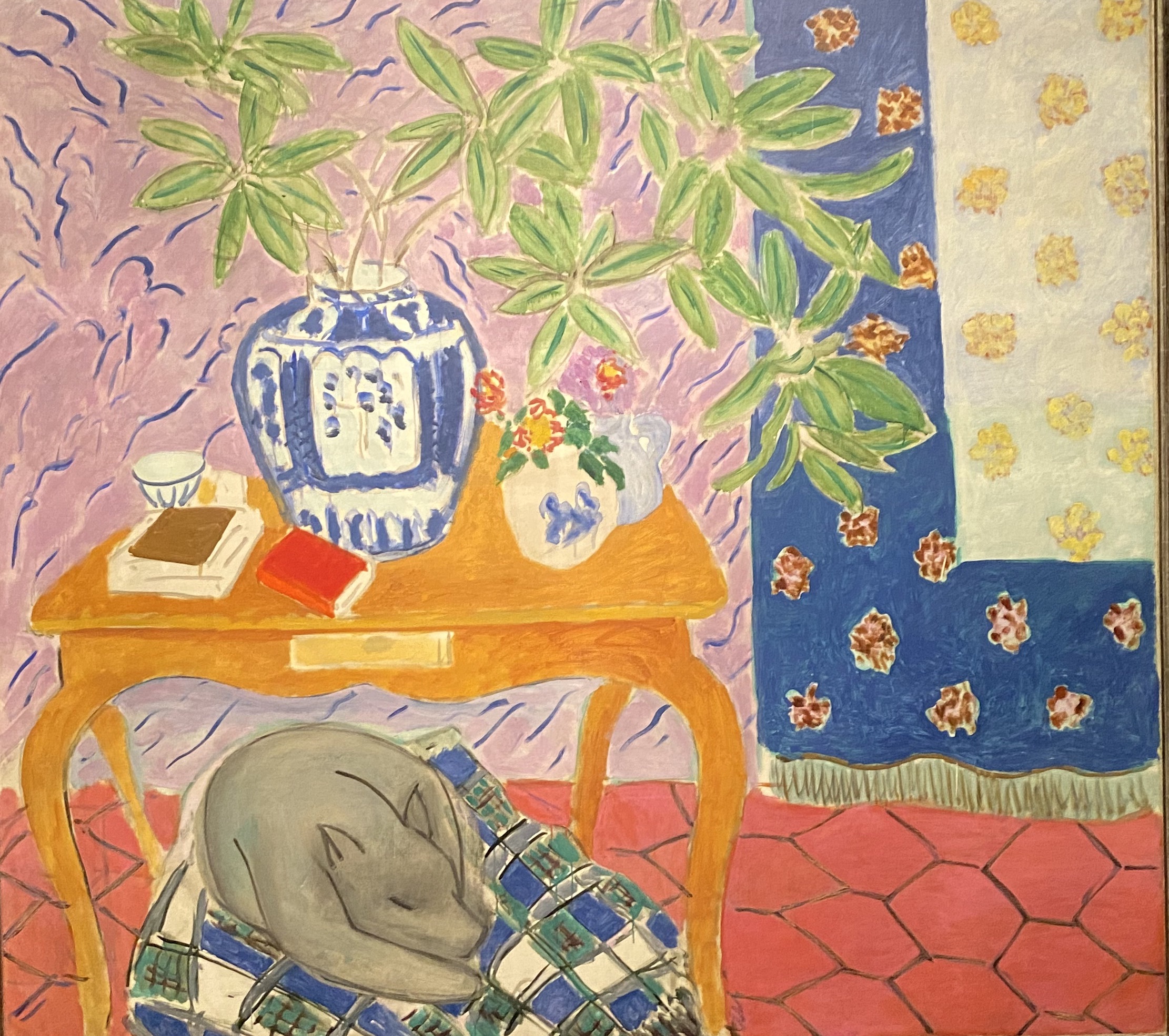
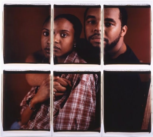
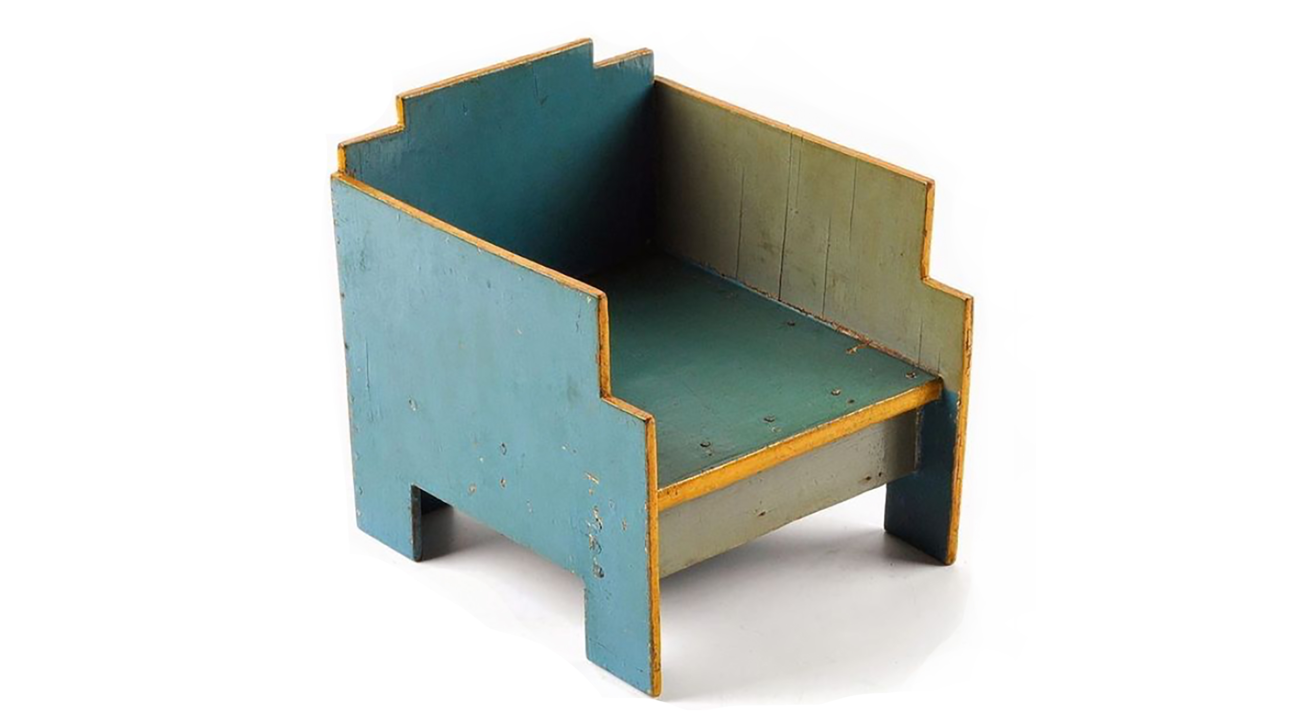
 Courtesy of the artist.
For the past several years I have been working on a series of cartographic installations comprised of layers of hand-cut paper, light, and shadow. These constructions depict aspects of the world which we cannot normally see: a microscopic organism, an image from the depths of our interior anatomy, a labyrinth of pipes and systems buried beneath us, or the land we live on as it was 200 years before. I am interested in how these inaccessible places are transformed once they are flattened into two dimensions and mapped out, and how the visualization of information, a system, landscape or history, creates an abstraction that can be simultaneously informative and ambiguous.
The act of ordering our surroundings by way of a chart or image is both an effort to make sense of the tangle that is the world we live in and an investigation into that which we cannot truly know. Within this attempt to analyze environments through mapping, I go through a process of elimination, editing out all information except a minute selection that becomes illuminated. I often do this through physical removal, cutting out everything except the imperative line and thus creating maps that are equally informed by voids and positive marks. Through this process of cutting, an intricate system of reflective shadows results, expanding on the actual object. These ghost lines often overpower the physical piece itself, creating an ambiguous space between what is solid and what is ethereal. I like to think of these spaces as a tangent to another layer of information that coexists with the solid elements.
In some of my most recent works, I reference systems that we utilize in everyday life, but are largely removed from our consciousness. Sprawling organisms such as urban sewer and water systems and the global network of pipes and refineries that develop and transport oil have been fodder for an investigation of the complex yet base, and at times grotesque, constructs that support modern society.
I am currently working on a new large-scale project based on the Arctic Ocean as a frontier made accessible by melting ice. For this project I will be working with the Center for Coastal and Ocean Mapping at the University of New Hampshire, a group that is mapping the sea floor of the Arctic Ocean, one of the least known and sparsely charted realms on the planet. This summer, I will be traveling to the Chuckchi Sea on an icebreaker with the CCOM-JHC where I will begin a project derived from the bathymetric data they are collecting (a book and large-scale installation). Their maps, eerie topographies from a world that has only been remotely seen through the use of sonar sensors and robotic underwater rovers, brings the unknown terrain of the sea floor into view. These visualizations also illuminate some of the geopolitical tensions that surround this frontier. As the polar ice melts, the race to lay claim to territories and accompanying resources heats up. As scientists collect data about the ocean floor, the information they cull lays the groundwork for “The Law of the Sea,” a yet-to-be-ratified United Nations treaty that will expand nation’s borders based on the location of a country’s continental shelf. This treaty has the potential to give countries that border the Arctic domain over the shipping routes and resources—namely oil and natural gas—that the promise of melting ice makes accessible. The Arctic, long romanticized and largely ignored since the 19th- and early 20th-century international race to reach the Pole, has suddenly become part of global debate and consciousness.
I hope that this new body of artwork will provide a platform for further discussion and deeper understanding of the complex political issues associated with Arctic mapping and the tensions associated with geopolitical resource economies.